Author: Deron

Sweat Rewards / Recompensas Sudoríparas

Sunday was a trailwork day and after a full day of cleaning, pruning and raking, now three more trails in the SFdA Smoking Section are ready to ride:

Trail E (Encendedor (Lighter))

Trail Ca (Calientaplatos (Hotplate)) (Trail page not yet posted. Damnit!)

Trail T (Tostadora (Toaster)) …except the upper section above Trail ML…which will hopefully get cleaned this weekend.


But, during that work, a new trail was stumbled upon between Trail E and Trail T.  Or, more accurately, an old (lost) trail was discovered.

Here is a a screenshot from Google Earth pointing out the potential new trail, as well as the surrounding trails.  Active map (and download link for the KML file) is below.

GMap Image of Trail _Hoguera and partner trails


The tread is fairly well established and the vegetation is only slightly grown in.  So, with a little trail work, another kilometer of singletrack could be added to The Smoking Section.  The exciting part is that it runs across the hill as compared to the other nearby trails and has a gentler grade of <12% as compared to 20% and 18% for Trail E and Trail T, respectively.  Also, the area it crosses has some broader sections that would allow for trail re-routing to give an even gentler grade and longer distance.  Right now it isn’t rideable, but we’re hoping to get some volunteers out to flag and clean it ASAP.  If you’re willing to help, drop us a line via a comment below, the OaxacaMTB.org Facebook page or the Contact Us form on this site’s About Us page.


Come help us build this baby!


OAXMTB YouTube Channel and First Trail Video

Two bits of news, campers:

1) Trail work on “Vela” is done and the trail is ride ready.  The upper part is still a bit thick with grass on the tread, but it opens up as you reach the middle and bottom.  Get out an ride it as the more it gets used, the better it will roll.

2) I finally got around to trying out my new GoPro knock-off video camera – an MHD (MonoPrice) Action Cam.  Earlier efforts using the chest harness were a total fail (unless you’d enjoy watching the trail tread go by with my knees wobbling around).  First halfway watchable video that I made is from a run down the freshly cleared “Vela” trail.  The video starts on Trail LLL, runs the bit of Trail PC that is used to get to Vela, and then ends as the 1 5meter walkout at the end of the trail where it pours back onto Trail TTT (aka Pista las carnívoras). The lighting is poor, there is a smudge on the camera lens, and I’m not sure I really like the handlebar mount perspective, but this is an experiment for now….


On that note, and with the hope that we will be able to provide a full collection of trail videos eventually, OaxacaMTB.org now has a YouTube channel to share these videos as they are created/provided.  That also means there is now a Google+ page to go along with our previously existing Facebook page.  We hope you’ll add these additional outlets to your social media lists.   Here are the links:


OaxacaMTB YouTube.com Channel

OaxacaMTB page on Google+

¡Feliz Navidad de Colorado, mis amigos!

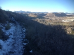
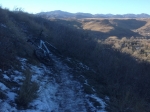
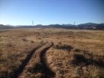
Hello, friends in Oaxaca!  I hope your holidays are going well.  My friend Carlos Silverberg (of www.MountainBikeOaxaca.com fame) teased me the other day via email saying he was headed out with a tour on the EcoTrail…the best downhill trail I know of in Oaxaca.  Although it’s a bit colder here in Colorado, United States, than in Oaxaca, I too was thinking of getting out on the bike.  Work and weather have gotten in the way of that for too many weeks here.  So, while Carlos and crew were out burning up some brake pads, I was out enjoying a delightful 60F December day on South Table Mountain.  Thinking of Oaxaca and many of you while on the trail, I thought I’d throw up some pictures…and a comparison elevation graph for my ride and the last time I did the EcoTrail with Carlos.


I’m looking forward to seeing you in January in OAX, friends!

Pre-ride of the route for the 2013-02-17 MTB Race

Larry and I went out today and checked out the expected route for the upcoming MTB race that will be here in our neck of the woods this Sunday, Feb. 17th, 2013 (i.e. the Las Carnivoras area near San Felipe del Agua).  The course is different from last year, and they’ve even cut a small section of new trail for the route.

Here is the map of today’s loop of the track.

New Trail (Work) Progress Report: Trail R to Road LNR Connector

So the new connector trail between Libremiento Norte Road and Trail R (Rebote/Ricochet) is mostly cleared of vegetation. Some of the switchbacks have been built for three to five more are needed. At this point, the tread is mostly packed grass except for the bottom part.

In the map, Trail R is in purple, the new trail…..as it stands right now…is shown in cyan.

Come help us finish up this trail.

%d bloggers like this: