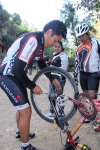
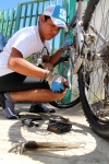
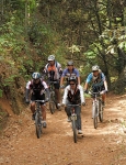
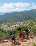
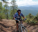
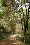
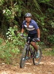
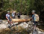
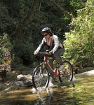
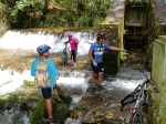
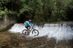
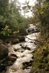
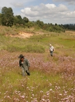
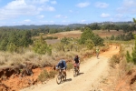
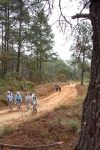
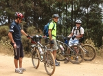
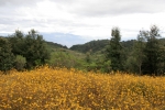
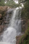
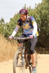
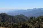
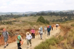
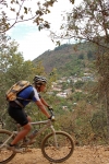
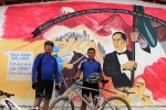
The small village of Guelatao, situated 52 kilometers from Oaxaca on Highway 175, is famous as the birthplace of Benito Juarez, likely the most famous (and possibly the only honest) president in Mexico’s checkered history as an independent nation. Two nearby towns are also somewhat famous and deserving of a visit: Ixtlan de Juarez and Capulálpam. The latter of these has the sort of ecotourism park common among villages in the Sierra Norte, all of which support mountain biking. One of the trails in the area – which consists almost entirely of a very pleasant logging road through the forest – runs 4.4 miles from the park until it deadends at the end of a short singletrack at a small water control dam. The ride out and back is a moderate endeavor, suitable for any rider of decent ability. Even at a leisurely pace the ride can be accomplished in three hours. The route shown in satellite view below includes a dogleg to a scenic point overlooking Capulálpam. As an added bonus, bikers can sightsee in Capulálpam, dine in Ixtlan and visit the memorial and museum to Benito Juarez in Gelatao – all of which make for a fine day’s outing. (The museum is supposed to be open and free Tuesday thru Sunday from 9 am to 4 pm. If it is closed, a key can be obtained at the municipal building next door.)
Category: Mountains
Countryside, GPS, Mountains, MTBing, Photos
Cuatro Venados Loop
by Larry • • 1 Comment
This loop ride is a cousin, of sorts, to the “San Pablo Cuatro Venados” ride which appears later on this page. Both versions of the ride begin and end in San Felipe del Agua, and both feature the very formidable climb up the mountainside to the tiny village of San Pablo Cuatro Venados. What sets this ride apart, though, is that it continues past 4 Venados, crossing through the high country at over 9000 feet elevation, then descends steeply through Santa Ines del Monte to Zaachila before returning to Oaxaca city (on mercifully level ground!). This is one of the epic rides around Oaxaca, and should not be taken lightly. The loop can be ridden in either direction, and is equally difficult either way. Pick your poison! If you can arrange a shuttle, you can eliminate the pain of the huge climb to Cuatro Venados and concentrate on the much more thrilling screamer of a downhill run back to Oaxaca.
The loop ride, start to finish, will take you 56.3 miles (90.6 km). The high point of the adventure is 9281 feet (2829 meters) in elevation. The uphill climb clocks in at 6219 feet (1895 meters). The ride is rated “Difficult” because of the length, steep gradients and altitude. There are no technical sections of trail (the entire route is on paved or dirt roads), but the unpaved sections can be quite rough in places and you will be moving at high speeds coming downhill.
Options for a shorter ride include starting and ending at the Zócalo in the center of Oaxaca rather than in San Felipe. This alone will take 7.0 miles (11.3 km) off the total distance. Using a shuttle to get to Cuatro Venados and riding just one way will cut the route in half. The segment from Cuatro Venados through Santa Ines to Zaachila amounts to just 11.3 miles (18.2 km), is mostly downhill and should take just 3 hours.
Countryside, GPS, Mountains, MTBing, Photos
Oaxaca to Juquila Pilgrims’ Route
by Larry • • 0 Comments
The notion of making a religious pilgrimage is an ancient tradition. In contemporary Mexico, the concept of making a pilgrimage to a religious shrine is very much alive and well. Almost two million people flock to the basilica of Our Lady of Guadalupe in Mexico City on her feast day (12 December). Here in Oaxaca state there is a lesser-known shrine to the Virgin Mary in the small mountain community of Juquila, 203 kilometers (126 miles) southwest of the capital. People from all parts of the state go there – many by bicycle or on foot – to lay petitions before the Holy Mother. Whether you want to visit Juquila out of religious fervor or just because it is a worthy destination for an epic bike ride, here is how to get there.
Be aware that this route is on the shoulder of the secondary highway linking Oaxaca city with the Pacific coast. The road is narrow, steep, very sinuous and has little or no shoulder. Vehicle use is light most of the time, and speeds are rarely higher than 30 miles per hour. There is a fair amount of pedestrian and bicycle traffic all along the way. Nevertheless, this is a hazardous route for cyclists, so be exceptionally vigilant.
GPS, Hiking, Mountains, MTBing, Photos
Cuajimoloyas Loop
by Larry • • 0 Comments
The village of Cuajimoloyas attracts a number of tourists. Its location high in the Sierra Norte (elevation: 10,398 feet / 3169 meters) is a draw, as are its hiking and biking trails. This short (3.1 mile / 5.0 km) loop trail is not worth driving all the way from Oaxaca city; but if you are already in the neighborhood, it’s worth checking out. Perhaps afterward you will want to take a ride on the community’s zip line, which is the longest and highest in this part of Mexico.
Foothills, GPS, Hiking, Mountains, MTBing, Ride Routes
San Pablo Etla Mountain Park – Loop 3
by Larry • • 0 Comments
There is an abundance of trails in the hills above San Pablo that are suitable for mountain biking. Here is another loop ride that is a variation on the theme established earlier with Loop 1 and Loop 2. The starting point and access routes are the same, but the lollipop loop that is the heart of this ride is different.
The biker attempting this ride will clock 9.1 miles (14.6 km) and find him or herself climbing and then descending a total of 2164 feet (650 meters) on mostly singletrack trail that winds through forested hillsides, often on rocky tread. The hardest climb, though, is on a dirt road that leads to the parking lot and community building at the new Mountain Park above San Pablo. After that, the grade of the singletrack trail is more moderate.

