Author: Larry

Biking Around Oaxaca During The Coronaviris Crisis

Both the city and the state of Oaxaca have been affected by the coronavirus crisis. The first two confirmed cases of Covid-19 were reported on 16 March 2020 and that number grew slowly over the next few weeks. As in cities around the world, steps were taken here to limit the spread of the pandemic. Most public venues (schools, movie theaters, ball parks, concert halls, etc.) were shuttered and gatherings of more than 10 people were banned. People were urged to avoid groups and distance themselves from others. Everyone was encouraged to stay in their homes. As a consequence, the city is eerily quiet, with little pedestrian or vehicular traffic about.

Mountain bikers have been affected, too, as local bike clubs cancelled their weekly group rides. However, individual riders continue to pedal trails in the mountains and around the Valles Centrales as a way of staying in shape and to keep from going stir crazy because of forced isolation. If anything, there seem to be more bikers on the Libramiento and the trail network in the hills above San Felipe del Agua than usual on weekday mornings. 

This post was put up on 1 April. It is hoped the pandemic will peak sometime this month and that the number of infections will begin to taper off in May and June. In the meantime, mountain biking serves as a way to keep one’s sanity in a world gone crazy.

San Agustin Etla Aqueduct Trail & More

Albi and Larry, two retired biking buddies who live happily in Oaxaca, set out one Monday in early March to test their strength and agility by riding along the aqueduct that carries water from a stream well up a mountain valley down to the water treatment plant in San Agustin Etla. This route is a perennial favorite among participants in the “Hoofing It In Oaxaca” program of weekly hikes and is equally prized by local mountain bikers. After registering and paying a nominal 50 peso permit fee, the two set out from the water plant and headed up the valley. The grade of the trail is quite mild, so the pedaling uphill was easy enough. More challenging were the narrow places where the trail balances on the edge of the aqueduct. There are also a number of spots where the trail jumps from one side of the aqueduct to the other. Most of these are bridged by planks of lumber which can be ridden over. The aqueduct terminates at a small water diversion dam in a mountain stream near the grand ruins of a hydroelectric plant built about 1900. From that point our intrepid duo continued onward, exploring a single-track trail that ran further uphill, generally following the stream. The trail had been recently groomed and marked for a mountain bike race, but even so the pair wished they had brought tools to prune back overhanging tree branches and clear brush from the trail. The riders decided to accomplish their return to San Agustin on a service road rather than retracing their uphill route, which made for a fast descent. All told, the ride covered 8.3 miles (13.4 kms), with an elevation gain and loss of 957 feet (292 meters).  The outing began at the water treatment plant, which sits at an altitude of 6371 feet (1925 meters), and topped out at 6897 feet (2102 meters). The elapsed time for completion of the loop was just over two hours.

Love Those Loop Rides!

     A sunny Sunday morning in late February beckoned three expat gringos to don their bike gear and go for a pleasant ride through the countryside in the rolling hills in the western part of the Etla valley. Pedaling up the highway that runs between the archeological sites of Monte Alban and Atzompa, they skirted around San Pedro Ixtlahuaca and then rode through San Andres Ixtlahuaca. From there the trio set off to the north on an unpaved road which looped up and over a ridge of hills and then descended into San Felipe Tejalápam. After stopping for a treat of ice cream bars, they then proceeded through San Lorenzo Cacaotepec and picked up the trail running along the abandoned railway tracks back into Oaxaca near the Central de Abastos market.

     Our intrepid riders rode a total of 30.3 miles (48.8 kms) on their four-hour-long outing, managing to gain and then lose 1713 vertical feet (522 meters) of elevation along the way. Here is a satellite view of their route:

Monster Rides

     The members of the Pedalazos bike club have embarked on a couple of monster rides on recent Saturday mornings. These epic excursions took most of the day and entailed huge climbs and descents, challenging even the toughest of riders.

     The first of these was a grand loop covering 48.5 miles (78.0 kms) from Oaxaca city through the small mountain hamlet of Arroyo Guacamaya, then continuing up and through the Sierra Norte mountains on logging roads to the ecotourism camp at La Cumbre Ixtepeji and then down the La Reina trail into Huayapam, concluding in Oaxaca about nine hours later. The outing began near downtown Oaxaca at an elevation of 5124 feet and topped out at a high point of 10,398 feet (3169 meters). Those who survived the ride managed to pedal uphill 7008 vertical feet (2136 meters), to be rewarded with 7073 feet 2156 meters) of vertical drop coming down off the mountain. Talk about an endurance contest! Kudos to all those stout – or foolish – enough to take on the challenge!  Here is a map of the day’s route:

     Several weeks later stalwart riders in the club set out on a similar epic ride, this time pedaling east of the city to the famed weaving town of Teotitlan del Valle, then tackling the unpaved road that winds eleven miles steeply uphill to the village of Benito Juárez. From there the group proceeded 10 kilometers to La Neveria and then dropped down the loose and steep Mil Rios trail, which comes off the mountain near the town of Tlalixtac. Start to finish, the circuit ride covered 45.3 miles (72.9 kms), with over 6250 feet (1905 meters) of vertical gain and loss. The excursion took 9 hours and 40 minutes to complete. Again, congratulations to those who persevered to the end, despite some serious crashes on the treacherous downhill Mil Rios trail!  Below is a map showing the route taken:

Oaxaca-Zaachila-Cuilapam Loop Ride

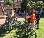
Five gringo bikers decided to go for a ride on Thursday, 6 February through the countryside to the south of Oaxaca city. They rendezvoused at 10 am and proceeded to pedal 25.5 miles (41 kms) through the mostly flat terrain of the Zimatlan Valley, stopping at the weekly market in Zaachila for breakfast before ambling west and then north on country lanes to Cuilapam and then back to the capital city. This was intended to be a social ride, so no speed records were set – especially since Dwayne’s rental bike suffered a flat front tire three times along the route. The ride was capped off with some appetizers and cold bear at the Coco Beach restaurant when the group returned to Oaxaca at mid-afternoon. A good time was had by all.

%d bloggers like this: