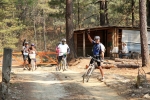
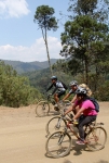
Not all the old logging roads in the mountains around Oaxaca city go from point A to point B (many dead end someplace in the forest). Some, however, make for a fine ride that will actually take you someplace. Such a road is the one that winds from Arroyo Guacamayas to La Cumbre Ixtepeji. Like most logging roads, this one follows the contour of the land, winding through the hills, alternately rising over ridges and dropping through valleys at a moderate grade. No special bike handling skills are required for this outing, but the rider should be in good condition, as the way is long, the overall elevation gain and loss is significant, and the road runs at a fairly high altitude. The out & back trip will carry you 31.5 miles (50.7 km), with an elevation gain & loss of 5114 feet (1559 meters). Nice!
This ride is listed as an out & back adventure – and that is how it is shown on the map and elevation chart below. As such, it can be started at either end. It is also possible to start the ride in Oaxaca, making either a greatly extended out & back or a truly spectacular loop ride. The out & back from Oaxaca to Guacamayas and on to La Cumbre and back will clock in at 74 miles (119 km). Whoa! That’s serious mileage, and will take even a strong biker all day, so start early!
Prefer to do a loop ride instead? Then be sure to ride clockwise (Oaxaca > Guacamayas > La Cumbre > Oaxaca), as the ride down from La Cumbre to town will be on Highway 175 – a well-paved but narrow and very twisty (not to mention quite busy) main road with absolutely no shoulders. Going downhill, you’ll be able to match the speed of motor vehicles, which is a much better option than trying to ride uphill, forcing drivers to dodge around you, often on blind corners! The loop will put 57 miles (91.7 km) on your odometer, which – together with the elevation gain of about 6800 feet (2062 meters) – should give your legs a considerable workout.


