Category: Photos

Indicates the post includes photos.

Riding High to Beat the Heat

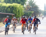
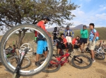
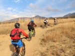
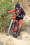
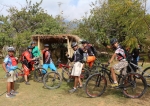
It is early April in Oaxaca, and hot! The thermometer has been registering in the mid-90s Fahrenheit (mid-30’s on the Celsius scale) on many recent afternoons. So the plan for our group ride this Sunday was to head into the mountains where it would be cooler. To our surprise, there was heavy cloud cover when the sun came up, and the nearby peaks were completely obscured. We packed rain jackets, just in case! There were just four gringos in our little group — Larry, Deron, Jordan and David. After some discussion, we decided to drive to La Cumbre and ride “El Cerezo” (“The Cherry”) and then the 204 Trail. As we passed the monument to Benito Juárez on the east side of town we noticed another group of local mountain bikers packing their gear into a camioneta, obviously also heading into the hills. Turns out they planned to ride the same two trails we had selected. As we all arrived at La Cumbre at the same time, we joined forces. Now there were a dozen of us to shred the trails together. And, happily, the cloud cover was breaking up and the sun shining through as we began our ride.

This being far into the dry season, there was lots of loose, dusty soil and a dense mat of fallen pine needles on the ground, so caution was needed on the steep downhill sections of “The Cherry”, which ran for 3.2 miles (5.1km) from end to end, dropping 1830 feet (558 meters) along the way. We were pleased to see several more small ramps have been added to “El Cerezo” in recent months, indicating people are both using and making improvements to the trail.

Once arrived in El Punto, we loaded all twelve bikes and riders into an extended-cab pickup truck to cover the 5.4 mile (8.7 km) drive back up to La Cumbre and then down a side road to the point we unloaded our bikes and began riding.

Our shuttle dropped us off at the high point on the gravel road, giving us some extra swooping descent on the way to where the 204 Trail takes off into the woods. On this section of the day’s outing we covered 7.0 miles (11.3 km) and added another 3339 feet (1017 meters) of downhill before the trail connected with Highway 175 in the valley below. From there it was another 3.2 miles (5.2km) on the paved road to the presas in Huayapam, where half of the group stopped for cold drinks and lunch while the rest of the gang pedaled back to Oaxaca. All in all, it was a fine day of mountain biking!

Western Etla Valley Foothills

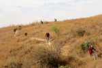
Sunday, March 13th was a day of clear skies and warm temperatures.  D.,  C., C., P., and E. met up on the highway out Etla way to explore some of the network of paths, trails and dirt roads on the western side of the Etla valley in the scrub-brush covered foothills that sit between the toll highway to Puebla / Mexico City and the pine-covered mountains.

Introducing a Colorado Mountain Biker to Oaxaca’s Trails

Spencer, who hails from Boulder, Colorado, was spending a few weeks in Oaxaca and was anxious to acquaint his Yeti mountain bike with some of our favorite trails. So on this Thursday in early February some other gringos who call Oaxaca home (two of whom are also from Colorado) decided to introduce Spencer to the wholesome goodness of the trails above San Pablo Etla — specifically, the Oaxaca Flume Trail. The group arrived in San Pablo at about 10 am and hit the trail soon after. It is a long slog up a rather steep (11% to 12% grade) dirt road that leads from the valley floor up past the “La Mesita” reforestation area in San Pablo’s mountain park (where an admission fee of 30 pesos per person must be paid) and then continues upward to the start of the Flume Trail. Actually, the climb is just 3.5 miles (5.6 Kms), but it seems much longer, as the elevation gain amounts to 1937 feet (590 meters) and the grade is relentless.  The single track Flume Trail is a skinny, little-used path which — today at least — was heavily overgrown with brush. Though almost entirely downhill, it is still a demanding ride because of the terrain and the downhill slope — which in places has up to a 26% pitch. On this outing the group rode a total of 14.0 miles (22.5 kilometers), starting from a friend’s home and winding up at an open-air comedor in the center of San Pablo.

Breakfast Stop In Huayapam

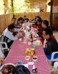
Today’s Sunday morning shop ride sponsored by Summit Cyclery was essentially a breakfast outing. After a rather mellow ride through the open country between Oaxaca and the nearby village of Huayapam, the group stopped for a substantial and satisfying breakfast at a home-based restaurant in that town. Afterwards the gang returned by a more direct route, stopping for more refreshments at Cafe Brujula, just a few blocks from the bike store.

The total round trip distance on today’s excursion amounted to 10.7 miles (17.2 km), with an elevation gain and loss of 1189 feet (362.4 meters). The Summit Cyclery bike shop was the lowest point on the route at 5190 feet (1582 meters), while the highest point on the trail registered 5636 feet (1717.5 meters) in altitude.


Pedaling with the Pedalazos

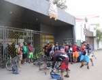
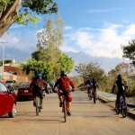
There is a relatively new mountain bike club in Oaxaca called “Los Pedalazos.” They meet for a group ride twice weekly — at 4 pm on Wednesday afternoons and again at 8 am on Saturday mornings. The Wednesday rides are shorter, given the hour of the day, and may require the use of lights if the group will be out after dark. The Saturday rides are longer — both in terms of distance traveled and time in the saddle. The outings are announced on the club’s Facebook page a day or two before the ride — see https://www.facebook.com/groups/pedalazos/.

The ride today (Sat / 19 Dec 2015) was a long loop running from the Casa Cultural in downtown Oaxaca out to San Bartolo Coyotepec in the Zimatlan valley, then over a mountain ridge and into the Tlocolula valley, passing through the villages of Rojas de Cauhtémoc and Tule, where the gang stopped for a very welcome lunch at a local comedor before continuing back to Oaxaca.

Seventeen riders were on hand for the start of the ride, but one dropped out because of mechanical problems and another in the face of some steep uphill climbs. The remaining fifteen completed the 31.8 mile (51.2 km) loop ride in approximately six hours, counting time spent relaxing and eating lunch in Tule. The low point on the ride dipped to 4989 feet (1520.6 meters), while the high point on the ridge separating the two wings of the Valles Centrales topped out at 5912 feet (1802 meters). There was a total of 1982 feet (604 meters) elevation gain and loss going around the loop.


%d bloggers like this: