Category: Outing

A description of a particular event or day out and about having DONE something. Outings are things that have occurred. Trails & Ride Routes are conceptual items that can be used by others to plan and complete their own outings.

Oaxaca Flume Trail

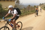
For the first of the Weekly Thursday Rides, we headed over to San Pablo Etla to see if we could find some of the singletrack trails Carl Silverberg and his amigos have been building. Not only did we find some new singletrack (new to us, that is), I also got to meet Carl. He is a super nice guy who’s done a lot to bring attention to Oaxaca mountain biking AND to work with the communities here to create and maintain more mountain-bike-friendly singletrack. I’m hoping to get back over to Etla and ride with Senor Silverberg soon. We are also planning to get over there for some trail work as the rainy season has, of course, affected those trails, too.

Carl’s MTB-guide company is on the Web at www.MountainBikeOaxaca.com

Here is the track Larry and I took yesterday. Note that many of the “wiggles” are due to us scouting singletrack at various trail junctions. Looks like there are lots of riding options in the Land of Carl(os) S.

 

Latuvi / Benito Juarez / La Neveria Loop Ride

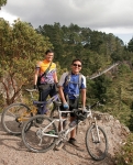
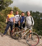
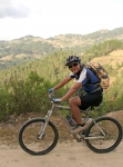
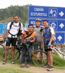
This is a lovely loop ride between three communities in the Pueblos Mancomunados, mostly on dirt roads but with some rough singletrack on steep hillsides in the forest mid-way between La Neveria & Latuvi. Most of the ride is at elevations between 9,000 and 9,500 ft (2745 – 2895 meters). The total distance is 19.6 miles (31.5 km). There is 3663 feet (1116.5 meters) of climbing along the way — but that includes a visit to the scenic overlook (“mirador”) above Benito Juarez (which is well worth the stop, by the way).

It took our group nearly six hours to complete the ride, but that was because we had some slow riders, stopped at the Mirador, and then had dinner in Benito Juarez. Experienced riders can probably knock out the loop in about half that time. Incidentally, we started and finished the loop in Latuvi because that put the biggest climb at the beginning of the ride. However, most people would likely prefer to begin at Benito Juarez, the town closest to Oaxaca city. We rode the loop clockwise, and think that is the best way; but it can also be done in the opposite direction.

Visitors to the Pueblos Mancomunados should be aware that the temperature in the high country is usually about 20 degrees Fahrenheit (6.6 degrees Celsius) cooler than in Oaxaca, and that morning fog and drizzle are commonplace, even in the dry season. For that reason, a light jacket and/or rain gear is recommended. Also, native guides are available to take visitors between villages on either hiking or biking trails, and may be hired for about 200 pesos for the day.


Upper Tostadora Pruned 2012-10-31

Went out and did a little pruning today on Trail T (Tostadora (Toaster)).  Sadly, there was only enough time to get the upper section between Trail HFR (High Flyer Ridge) and Trail ML (Mechero Lado (Side Burner)) beat back.  Hopefully there will be time soon to get out again and get the bottom part pruned so the rainy season’s vegetative growth is beat back enough to get this trail ready for ripping down.  I’d almost forgotten how fun and twisty this trail is. If you are willing to come help with the pruning of the bottom, drop us a line.

Here is a map of the area of interest. The pruned part of Tostadora is indicated with the wide red line.

Outing – 2012-10-28 Ride (aka Quality is job #1…NOT!)

We were headed to Mitla. I.e. a simple day of rolling country roads on a standard-issue beautiful Oaxaca day. Sadly, after one destroyed pedal+crank, a flat tire, a floppy seat, and a disentegrating rear sprocket we decided it was time to airlift out. Half the crew turned around and rode home, the other half took their collection of “bikes” to the highway and caught a collectivo home. The track is the full bike route. Most of the photos are from the Dainzu ruins. Very cool.


Outing – 2012-10-22 Ride (CM in Trouble)

Today’s ride was quick run of Trails TTT, RR, Es, ED, A and CM (~14km). The wild flowers are blooming all over, big areas of what appear to be wild marigolds/chrysanthemums? casting the trailside in yellows, oranges and golds. Other flowers of purple, red and white mixed in for good measure.

Here are some (lousy) photos.


Also, Trail CM is getting some “work” done on it. I.e. a bulldozer was working the eastern side of the singletrack section turning it into a “road.” Also, at one of the creekcrossings somebody has excavated a trench across the road, clearing out the rainy season’s sediment and plopping the excavated dirt across the road on the western side of the trench. It looks like a bridge may be coming, but for now, it’s a hike-a-bike section. Both of these trail issues are noted with placemarks/waypoints on the map below.

%d bloggers like this: