Category: GPS

Items containing GPS data (either the downloadable KML/Z or GPX file) &/or a map that displays such data.

Sunday in Huayapam

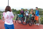
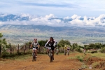
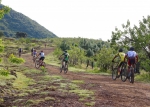
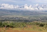
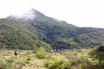
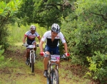
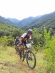
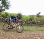
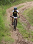
A dozen riders showed up at the Summit Cyclery shop for the weekly Sunday ride on the lovely morning of 4 October 2015. After weeks of almost daily showers, the rainy season seems to be coming to an end. At least on this day there was lots of blue sky to entice bikers out of bed, onto the saddle and into the hills around Oaxaca. The destination for the day’s outing was the nearby village of Huayapam — or more precisely, the network of back country roads and single track trail in the vicinity.

The group rode a total of 18.9 miles (30.4 km) between leaving the bike shop at 8:30 am and finishing the ride about 1:30 in the afternoon. The group enjoyed rolling terrain, with most of the hill climbing near Huayapam. Riders accumulated 1772 feet (540 meters) of elevation gain and loss going around the circuit. The low point on the day’s outing registered 5104 feet (1555.7 meters), while the high point topped out at 5714 feet (1741.6 meters).

Invalid Displayed Gallery
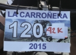
“La Carroñera”

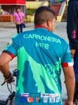
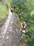
“La Carroñera” (“The Scavenger”) is an epic race held in the mountains just outside San Agustin Etla, a community a short distance to the north of Oaxaca city. On this particular day the contest drew a whopping 190 registered participants, all eager to test their mettle on this rigorous course, which ran 23.54 miles (37.88 km), using a combination of city streets, dirt roads, single track trails across the flanks of the mountain — and one section of tenuous trail running along the aqueduct that supplies water to San Agustin. There were three significant climbs along the way, the first being by far the longest and toughest, requiring contestants to use pedal power to gain 3711 feet (1131 meters) in altitude along the 7.2 mile (11.6 km) route from town to the highest point on the circuit — which topped out at an altitude of 9220 feet (2810 meters). The total elevation gain and loss riding around the course came to a whopping 6676 feet (2035 meters) — certainly a good day’s workout!

Those who preferred a somewhat less challenging course had the option of skipping the upper loop shown on the map. This reduced the overall length of the ride by 5.6 miles (9.0 km) and lopped off 2386 feet (722 meters) from the total elevation gain & loss for the day. Even so, the shorter ride totaled 17.9 miles (28.8 km) and demanded 4290 feet (1307 meters) of climbing and descending. Congratulations to all who completed the ride and earned a special medallion for their effort!


Single-tracking around La Cumbre

This Sunday (20 September 2015) the Summit Cyclery shop ride ventured into the high country around La Cumbre to sample two super single track trails. An assortment of trucks, vans and cars shuttled riders into the mountains and returned them safely to Oaxaca afterwards. The first part of the outing entailed entering the forest preserve at La Cumbre and riding the “El Cerezo” trail, a super downhill trail to El Punto. This trail has been upgraded recently, and a couple of jumps added to heighten the fun! Kudos to the crew that did the work! The El Cerezeo trail ran 3.45 miles (5.55 km), almost entirely downhill, losing 1730 feet (527 meters) in altitude. (First of the two maps, below.)

Once in El Punto, the group shuttled back up the highway and down a side road to the start of the 204 Trail. This, too, was a sizzling downhill run, made more adventurous by the mud on the trail and the moss on the rocks. Even new tires with stout knobbies were prone to slide around in the goo! Several riders took tumbles along the way, but everyone survived to tell their tale. This second trail of the day’s outing ran 5.3 miles (8.5 km), losing 2711 feet (826 meters) in elevation along the way. (Second of the two maps, below.)


Invalid Displayed Gallery

Summit Cyclery Ride to Santo Domingo Tomaltepec

A bright Sunday morning enticed fifteen riders to show up for the weekly ride sponsored by Summit Cyclery, located in the Reforma neighborhood of Oaxaca city. The destination for the day was one of the mountain valleys east of the village of Santo Domingo Tomaltepec. Normally an outing in this area comes with the guarantee of getting wet, as there are numerous creek crossings going into and coming back out of the valley. However, the rains this summer seem to have skipped over this area, as the stream had little water in it and the two reservoirs that supply irrigation water to the community were very low.

Riders left Summit Cyclery at about 8:20 am and traveled 25.2 miles on the round trip excursion, passing through Tlalixtac on the way out and returning by way of Tule — where the group stopped to enjoy nieves of various flavors. In the course of the day they climbed about 1240 feet as they wound along the trail through the woods to the eventual turn-around point.

Mountain Bike Race at San Lorenzo Cacaotepec

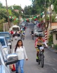
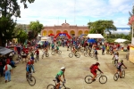
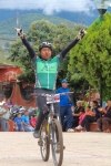
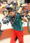
The village of San Lorenzo Cacaotepec is located in the Etla valley 9.5 miles (15.3 km) north of the zocalo in Oaxaca city and sits near the Atoyac River. The town marked its patron saint’s feast day with a community-sponsored mountain bike race on Sunday, 16 August 2015. The race was conducted under the auspices of ACEOVA, but not ACCREO, and so did not draw as many participants — and none of the major race teams — as most such contests. However, those who took part, especially the kids, made up in spirit for what was lacking in numbers.

The race course was a combination of city streets, country lanes and a bit of single track trail through farm fields. The loop course ran 2.6 miles (4.2 km), with a very modest elevation gain and loss of 254 feet (77.4 meters) and no technical challenges, making it one of the shortest and easiest race venues in the area. Contestants rode the circuit four times to complete the race. On-site race registration began at 9 am, with the race itself getting under way at 10 am.


%d bloggers like this: