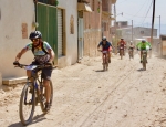
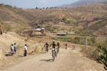
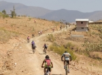
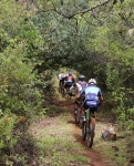
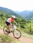
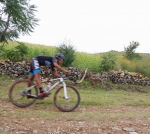
The summer rainy season of 2017 has proven exceptionally wet. It may not match the record precipitation measured in 2010, but it must be close and has certainly put an end to the drought conditions of the past two years. The month of September was particularly gloomy and wet, with hardly a glimpse of blue sky. So when Ron and Larry set out on 3 October for a gentle ride in the countryside of the Zimatlan valley, they were not surprised to find lots of mud on the dirt roads that criss-cross this agricultural region. Ron picked the route, as this was his first mountain bike ride in Oaxaca and he wanted to stick with flat terrain. The idea was to load our bikes in a van and drive to Zegache, then do a loop through the countryside to Ocotlan and back. In this regard we can report “mission accomplished”. We pedaled 14.7 mi (23.6 kms) on the route, with an elevation gain and loss of less than 350 feet (106 meters). We rode at a leisurely pace and stopped at several places along the way, including to visit the Rodolfo Morales museum in the monastery the famous artist restored in the center of Ocotlan. Unfortunately the parish church in Zegache, which Morales also had rebuilt and then painted, was damaged in the earthquakes of 7 and 19 September, and so was not open to the public. Also, to our dismay, there were very few fields of flowers to be seen in the area, which normally produces most of the flowers used to decorate graves and family ofrendas for the “Day of the Dead” festivities at the end of October. Many of the farm fields, in fact, were under water. A special highlight of the ride was the discovery of a beautiful wall mural on the main street of Santiago Apostol protesting the introduction of genetically modified corn into Mexico — see photo, below.
Category: Trail Info
Countryside, GPS, MTBing, Photos, Trail Info
Titan Zapoteca 2017
by Larry • • 2 Comments
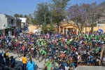
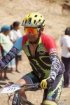
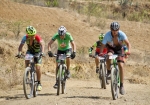
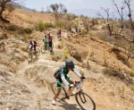
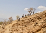
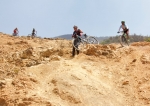
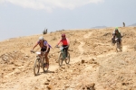
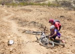
The mighty Titan Zapoteca marathon race held each spring in San Pablo Guila has become one of the premier mountain bike events in Oaxaca state. This year’s installment, which took place on Sunday, 26 March 2017, attracted over 400 registered participants — and a number of non-racing followers, like our little gringo group. As in past years, the race course was very challenging, with multiple long climbs and many treacherous descents. The race course is formidable, running for 42 km (26 miles) through the countryside, with steep climbs and scary, very technical descents. The total elevation gain and loss on the loop course amounts to over 1128 meters (3700 feet).
GPS, Mountains, MTBing, Photos, Ride Routes, Trail Info
Llano Grande in the Rain
by Larry • • 2 Comments
It was bright and sunny when 29 members of the “Nitos Ciclistas en Movimiento” bike club set out from Oaxaca at 7:15 am for a day ride at Llano Grande on Sunday, 25 October 2015. A caravan of ten cars and trucks hauled the riders, family members and their equipment the 42.2 mile (67.9 km) into the Sierra Madre. Unfortunately, heavy cloud cover rolled across the mountains and light rain began falling mid-way through the ride. The fog and rain prevented the group savoring the vista from the mirador, but made the forest vegetation seem more lush. Temperatures were mild, so everyone seemed to enjoy the outing, despite getting quite wet and muddy. The mud made for slow going; and tree roots and wooden bridges were especially slippery and dangerous. However, everyone made it safely through the ride and then enjoyed a hot lunch at one of the comedores in town before the group returned to Oaxaca.
Guides from the ecotourism camp at Llano Grande lead the way on a double loop through the dense woods. The route covered 9.95 miles (16.0 km), with an elevation gain and loss of 1812 feet (552 meters) for the day. Llano Grande sits at an altitude of 10,143 feet (3091.5 meters). The mirador was the highest point of the day, at 10,941 feet (3334.8 meters), while the cascada was the lowest point at 9635 feet (2936.7 meters).
Foothills, GPS, MTBing, Photos, Trail Info
Riding the San Felipe del Agua Trail Network
by Larry • • 0 Comments
Sad to say, as of late summer in 2021 the terrific trail network described below was closed to hikers and mountain bikers. People buying property in the hills and constructing homes there prevailed in posting notices that the area was off-limits to recreational users; fences and gates were put up and the major access routes closed by chains or other barriers. What a shame that such a wonderful asset – one that had drawn people into the outdoors for generations – was lost to the public.
With the great trail network in the hills above San Felipe del Agua so close to Oaxaca city, it is not surprising that lots of people go mountain biking there, especially on Sundays. The gang at Summit Cyclery chose to ride there on 11 October 2015. There were 17 participants in this day’s outing — mainly young riders, but with one old guy (the author) plugging along, taking photos and GPS measurements.
The ride circuit covered 14.7 miles (23.6 km) start to finish, with an elevation gain and loss of 2146 feet (654 meters). At its highest point, the trail topped out at 6306 feet (1922 meters). The group rode several of the well-established trails on the mountainside, including some that have suffered significant erosion damage in the past year or so. (Note to self: we need to get a trail maintenance crew out there!)
Invalid Displayed Gallery
Countryside, Foothills, GPS, Mountains, MTBing, Photos, Racing, Trail Info
“La Carroñera”
by Larry • • 3 Comments
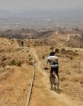
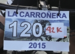
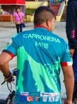
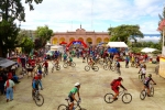
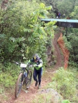
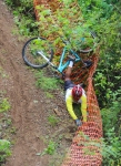
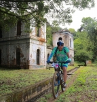
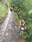
“La Carroñera” (“The Scavenger”) is an epic race held in the mountains just outside San Agustin Etla, a community a short distance to the north of Oaxaca city. On this particular day the contest drew a whopping 190 registered participants, all eager to test their mettle on this rigorous course, which ran 23.54 miles (37.88 km), using a combination of city streets, dirt roads, single track trails across the flanks of the mountain — and one section of tenuous trail running along the aqueduct that supplies water to San Agustin. There were three significant climbs along the way, the first being by far the longest and toughest, requiring contestants to use pedal power to gain 3711 feet (1131 meters) in altitude along the 7.2 mile (11.6 km) route from town to the highest point on the circuit — which topped out at an altitude of 9220 feet (2810 meters). The total elevation gain and loss riding around the course came to a whopping 6676 feet (2035 meters) — certainly a good day’s workout!
Those who preferred a somewhat less challenging course had the option of skipping the upper loop shown on the map. This reduced the overall length of the ride by 5.6 miles (9.0 km) and lopped off 2386 feet (722 meters) from the total elevation gain & loss for the day. Even so, the shorter ride totaled 17.9 miles (28.8 km) and demanded 4290 feet (1307 meters) of climbing and descending. Congratulations to all who completed the ride and earned a special medallion for their effort!


