Category: Hiking

Items related to hiking (typically scouting outings without the bikes or items worth sharing but NOT worth riding).

Ixtlan Revisited

In November of last year (2013) we visited Ixtlan de Juarez. Unfortunately, cold, rainy weather cut short our exploration of the miles of logging roads that create a maze in the hills above the town. We returned yesterday (5 January 2014) in excellent weather and rode a very satisfying 11 mile (17.7 km) loop, beginning and ending at the main church in town.

Except for the small portion on paved city streets, the entire loop is on dirt roads which are in relatively good condition and have decent gradient. There are numerous junctions with lesser trafficked logging roads (we stayed on what seemed to be the most-used road) along the route and a couple of single track trails that dropped off into the woods.

The loop can be ridden in either direction, but clockwise is recommended, as that way the grade going uphill is a  manageable 5.8%, whereas the descent averages a “Yee-haw!” 9% for a fast paced, brake-burning downhill run.

The ride begins in the center of town, at an elevation of 6505 feet (1983 meters) and tops out at 8556 feet (2608 meters). The total elevation gain pedaling 7.0 miles (11.3 km) to the top amounts to 2119 feet (646 meters), with a scant 33 feet (10 meters) of downhill along the way. The blistering 4.0 mile (6.4 km) descent is even more consistent, with a meager 20 feet (6 meters) of climbing thrown in for grins.

Give yourself a whole day to play in the forest and enjoy riding this and other nearby trails.
Tlalixtac – Lower Mil Rios Trail

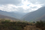
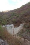
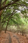
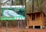
The small village of Tlalixtac lies 5.4 miles (8.7 km) east of Oaxaca city, a short distance north of the main highway to Tlacolula and Mitla. A number of good bike rides pass through this little town. This particular outing originates at the town square and proceeds on dirt roads and rocky singletrack up into a nearby mountain valley that provides water and firewood to the inhabitants of Tlalixtac. The road exists to service the four dams constructed in the lower part of the valley. Beyond the dams the path gradually diminishes until it is a narrow track through the forest — sometimes smooth and flowing; at other times studded with rocks. A skilled biker can ride the whole thing; average riders will likely have to hike-a-bike from time to time. There are fifteen creek crossings between the dams and the cascada at the far end of the valley (that makes 30 crossings out & back), but many are dry or have little water, depending on the time of year. There are no grand vistas to lure you up this trail, but you will surely enjoy the shady, winding path into the hills. This is also an excellent hiking trail, so feel free to ditch your bike and continue on foot if the going gets too intimidating for two-wheeled travel.

The distance from the Tlalixtac town center to the cascada is 13.7 miles (22.0 km) round trip, with an elevation gain and loss of 1283 feet (391 meters). If you choose to ride from the Zócalo in central Oaxaca (as shown on the second map below), you will accumulate a total of 24.5 miles (39.4 km) on the round trip, and the elevation gain & loss will amount to 2602 feet (793 meters).  Either option is a pleasant ride.

Cuajimoloyas Loop

The village of Cuajimoloyas attracts a number of tourists. Its location high in the Sierra Norte (elevation: 10,398 feet / 3169 meters) is a draw, as are its hiking and biking trails. This short (3.1 mile / 5.0 km) loop trail is not worth driving all the way from Oaxaca city; but if you are already in the neighborhood, it’s worth checking out. Perhaps afterward you will want to take a ride on the community’s zip line, which is the longest and highest in this part of Mexico.


San Pablo Etla Mountain Park – Loop 3

There is an abundance of trails in the hills above San Pablo that are suitable for mountain biking. Here is another loop ride that is a variation on the theme established earlier with Loop 1 and Loop 2. The starting point and access routes are the same, but the lollipop loop that is the heart of this ride is different.

The biker attempting this ride will clock 9.1 miles (14.6 km) and find him or herself climbing and then descending a total of 2164 feet (650 meters) on mostly singletrack trail that winds through forested hillsides, often on rocky tread. The hardest climb, though, is on a dirt road that leads to the parking lot and community building at the new Mountain Park above San Pablo. After that, the grade of the singletrack trail is more moderate.

Prune your way to the slide

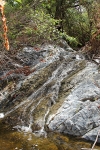
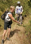
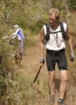
Larry and I headed over to Etla San Pablo to meet up with Carl Silverberg (owner of MTB guide company www.MountainBikeOaxaca.com ) to help out with pruning back the rainy-season vegetation growth on some of the trails. Also, we wanted to look at a section of a trail that was washed away by a landslide so we could try and see what the options would be for getting the trail rerouted or repaired.  We ended up scouting around the slide area for a reroute but it’s looking (to me) that the area is too steep and wooded to get an alternate route punched in by going up and over the slide area back to the continuation of the trail to the east.  Head scratcher.  Ideas, anyone? My vote is for building a zip line across the ~ 7m gap of lost trail. 😉

Here is the GPS data map (as KML) for the day of pruning. Grab it for yourself using the Download link in the base of the map below. GPX format is here.


%d bloggers like this: